Wisconsin Buffer Initiative

Universal Soil Loss Equation
Karthikeyan Research Team
The WBI was charged with developing scientifically defensible data and methodologies that support the development of a statewide buffer program in order to alleviate water quality problems in the state of Wisconsin.
An important step in the development of a statewide initiative is to bridge the gap between the watershed simulation scales of lumped parameter hydrologic models and physically based hydrologic models.
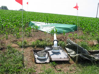
The Karthikeyan research team worked to examine Digital Elevation Model representation and the influence of scale on runoff routing in the agricultural watersheds of the WBI.
Topographic data, in the form of DEMs, are arguably one of the most important forcing functions in terms of the physics of the runoff process. Coarse scale DEMs (30 m or larger grid cell resolution) are widely available throughout Wisconsin; although it is questionable as to the utility that such data have for hydrologic modeling and buffer design. This is due in part to the micro-topographic influences that truly control the runoff process, such as tillage orientation, drainage ditches, outlet conveyances, culverts, or other such features. Although topographic trends (field slope) indicate the general direction of drainage, identification of fine scale relief features, which truly control the runoff process at the field scale, is critical for effective implementation of buffer systems.
In addition, topographic data processing techniques (Geostatistical analysis, kriging algorithms, stereo-image processors) may aggregate micro-topographic features such that they disappear from the digital landscape and are, therefore, removed from influencing runoff direction and quantity.
Research Objectives
- To determine the influence that spatial representation has upon hydrologic processes, particularly the rainfall-runoff transformation. Uutilizing DEMs developed from a variety of sources and scales, for a few representative field sites, and contrast those results with the finest scale and field survey topographic information.
- To recommend input data scales and DEM generation techniques based upon analysis of photogrammetric and DGPS data sources for use in the development and design of buffer systems for the WBI.
Details of the research can also be found here.